Editorial & Environmental Cartography
National Geographic Editorial Cartography
Maps produced for National Geographic editorial storytelling spanning wildlife, exploration, and environmental subjects.
- Year
- 2026
- Role
- Cartography Intern
- Organization
- National Geographic, Washington, D.C.
- Tools
- ArcGIS Pro, QGIS, Adobe Illustrator, Adobe Photoshop, MAPublisher
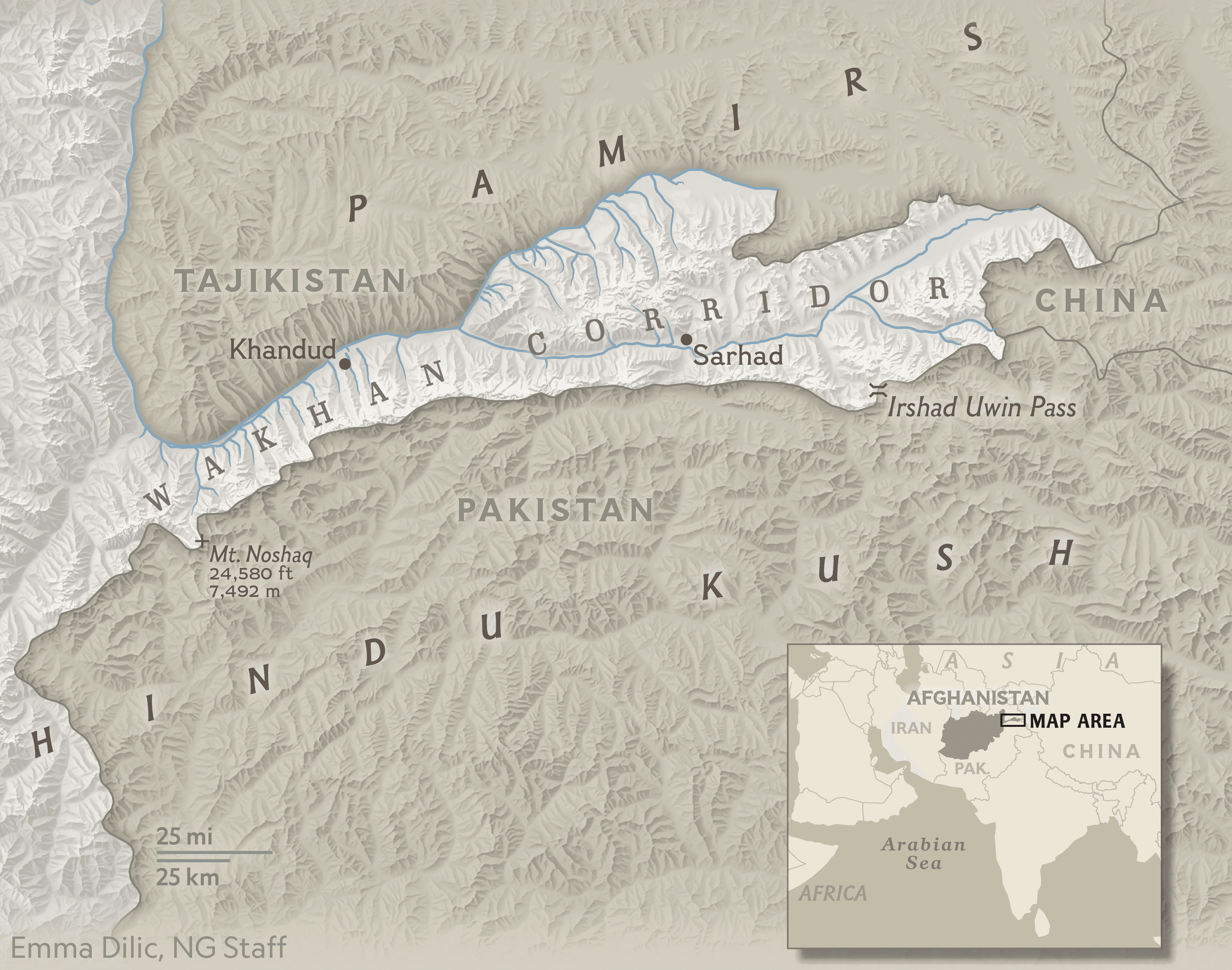
Research & Problem Statement
National Geographic's editorial team needed accurate, visually compelling maps to accompany stories on wildlife, exploration, and the environment — work that had to meet the publication's exacting cartographic standards while remaining legible to a general audience.
Project Description
As a Cartography Intern with National Geographic, I researched and visualized geographic data for environmental, wildlife, exploration, and global storytelling projects, translating source data and reporting into finished maps for print and digital publication.
Each map moved through iterative review with National Geographic's cartographers, text editors, graphic designers, and researchers to ensure geographic accuracy and editorial fit before publication.
Methodology
Built and refined spatial data in ArcGIS Pro and QGIS, then finished maps for publication in Adobe Illustrator, Photoshop, and MAPublisher, following National Geographic's cartographic standards for typography, symbology, and projection.
Maps & Visualizations
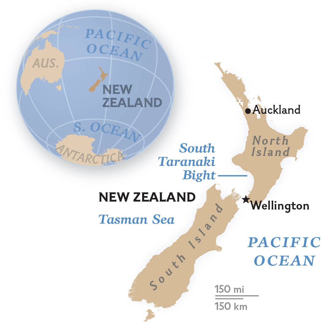
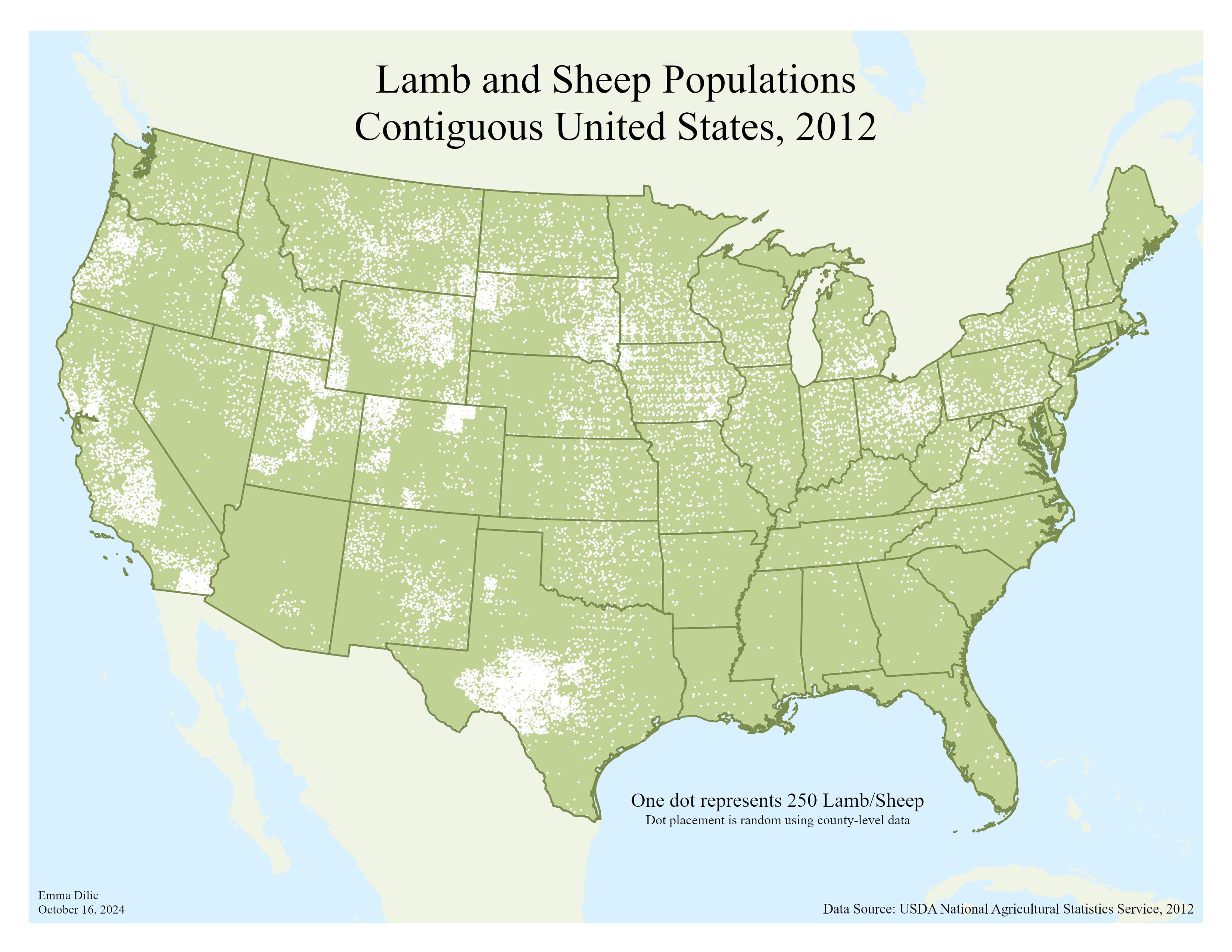
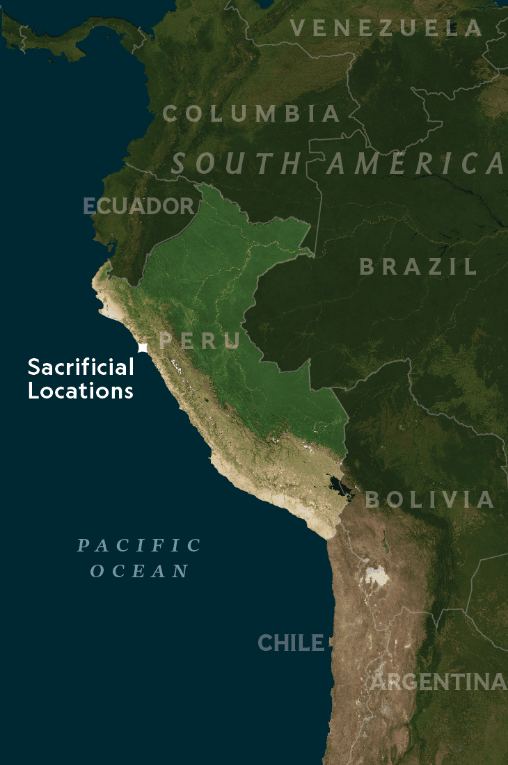
Results & Outcome
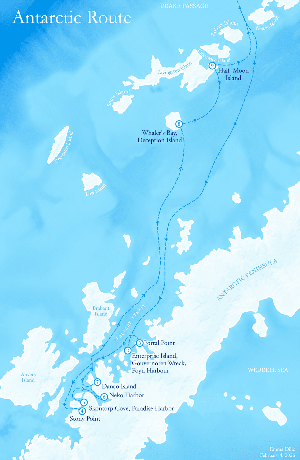
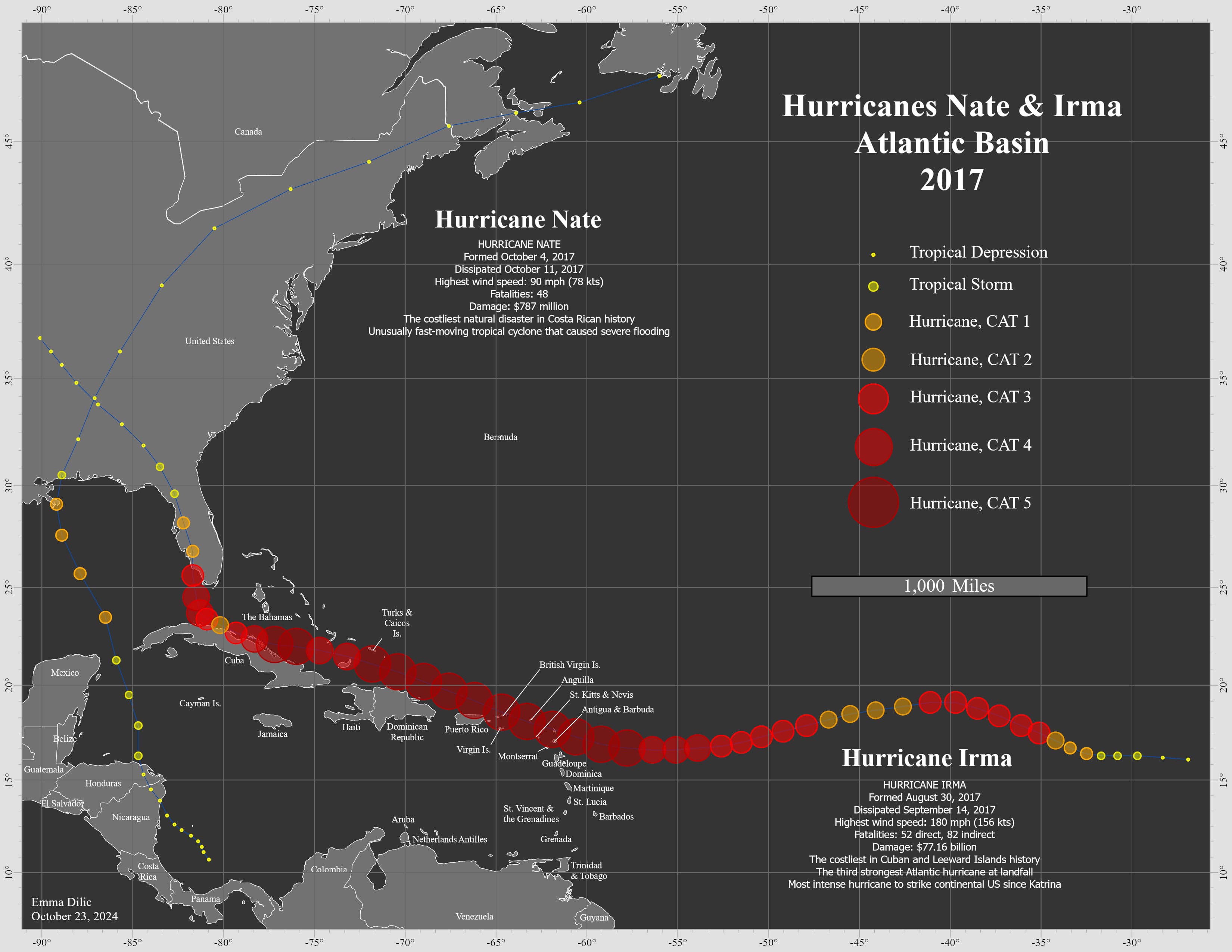
Selected maps from this body of work are shown below, spanning exploration routes, wildlife ranges, and environmental subjects.